Learning the art of underwater cave survey.
In a nutshell: During the Hands-on Cave Survey Workshop, you will create your own survey slate, collect accurate survey data, use computer software for cave survey for the first time and leave with your first cave survey file.
Over the last years, I have dedicated a great amount of time to surveying the caves I explore and to resurveying caves that I’m interested in and want to know better. Knowing the cave inside and out helps explorers plan how to push the exploration forward, how to connect caves and how to “read” the cave and how it develops. I want to share my knowledge and motivate people to survey as part of their journey in cave diving and cave exploration so I created the Hands-on Cave Survey Workshop, now available at our ProTec facility in Tulum.
Over the last week, I conducted two survey workshops with Igor and then Caroline. Both came to the workshops with different experiences and things they wanted to achieve. It was a whole ton of fun spending time with other passionate divers, and for me being able to pass on some of my experience and passion for cave survey!
Why learn cave survey?
This workshop will give you an appreciation for well-laid lines, help you to read and understand the cave development, and will give you the skills to begin your own resurvey project. For any meaningful exploration, a solid foundation of survey skill and experience is a must. If you don’t survey, you don’t know where you’ve been!
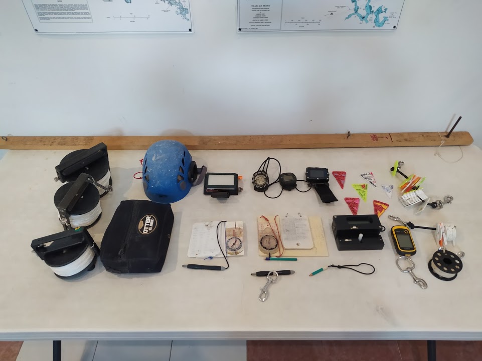
This is an advanced cave diving workshop so experience is required and being certified as a stage diver is a good idea to make the most of the workshop. We can tailor the workshop towards the interests of the individual diver and we can prepare you for the workshop with instructional dives or a cave stage deco certification prior to the class, just as Igor did. Typically, the workshop is taught over two days, focusing on manual hand survey, aka the old school (slates, compass, string), while we leave the Mnemo survey tool for when you’ve mastered the art of manual survey.
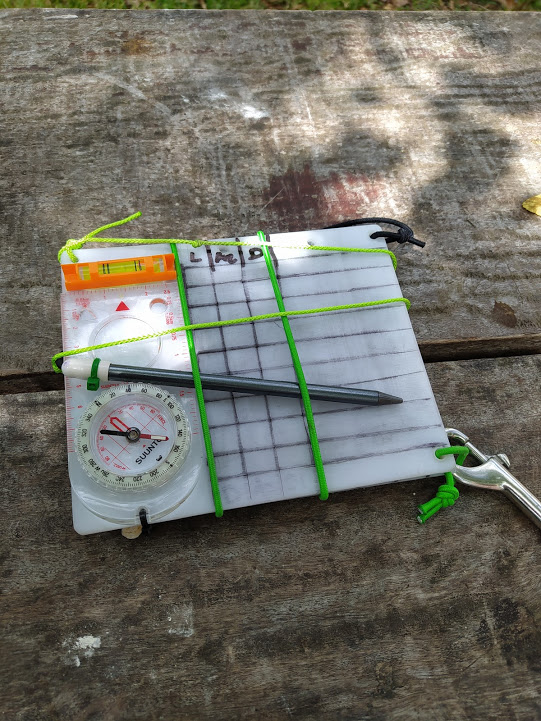
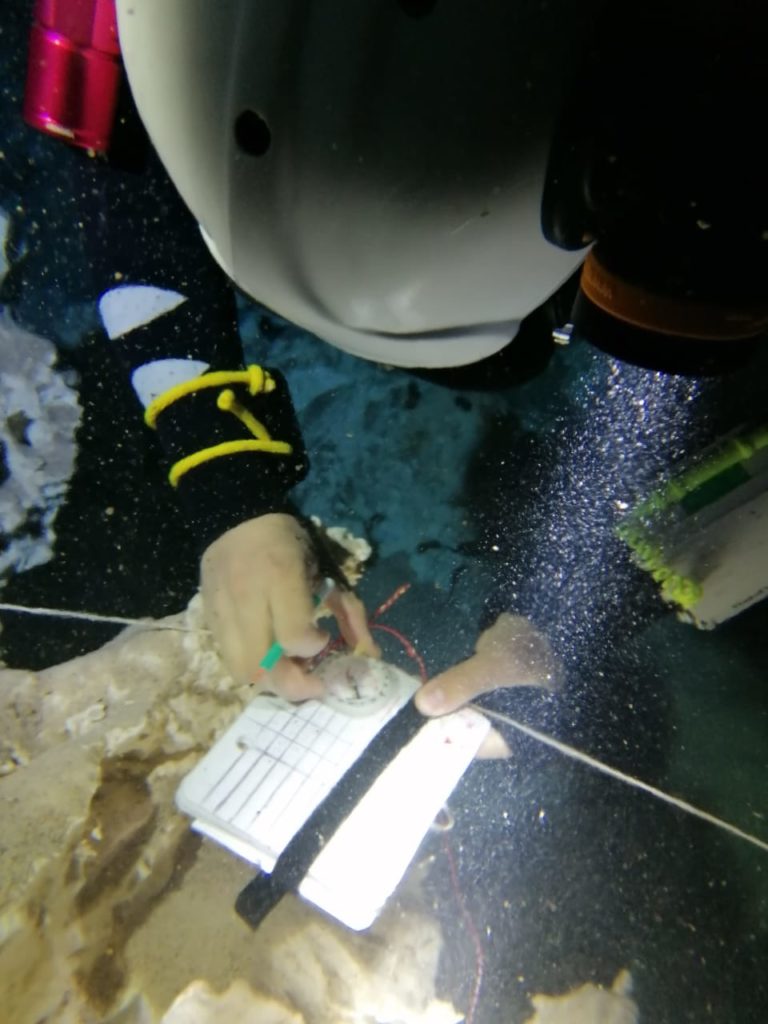
On the first day, we covered how to survey, different schools of thought, roles in the team, and had a whole lot of productive discussions in the classroom. A thorough gear workshop follows, including making your custom survey slate. Caroline, having a green theme in her gear needed her slate to have some green accents too!
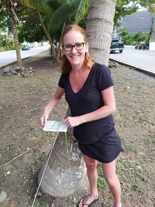
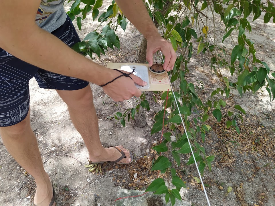
Once the slate is ready it is time to put into practice what we have discussed in the classroom. If you have ever done any training out of the Tulum facility the trees in front of the shop are probably familiar. I set out a few cave lines for us to practice surveying on, on land! We treat the line as a new project, taking a GPS point and then surveying everything. A few tips and tricks on the way for working with the slate, organising the data and we are ready to pull the lines out and use cave survey software for the first time. Just to contrast the hand survey with the Mnemo tool we also survey a few of the lines with that and compare accuracy.
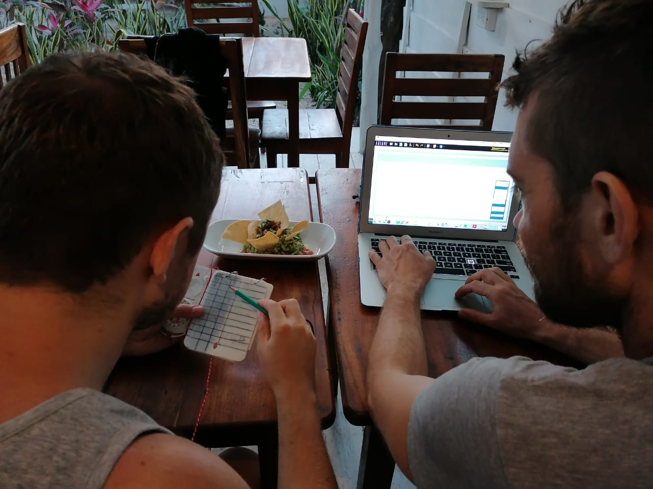
Back in the classroom, it is time to see how the data looks. During the workshop, we discuss different cave mapping programs but we use Ariane’s Line. Data gets entered into the program and we see our work for the very first time! It’s always interesting to see what the GPS accuracy can do to a survey! Once the manual survey is entered we also put in the Mnemo data. It’s amazing how efficient data entry is this way! We then compare the manual and Mnemo surveys for accuracy.
Day two of the workshop and it is time to put everything into practice underwater. To really have a good opportunity to practice survey skills in a safe and conservation-friendly manner we don’t go directly to the cave but practice in the cavern zone of a cenote like Carwash or Cristal. This gives students an opportunity to really focus on collecting good survey data without the stress of being far from the entrance.
Both recent workshops I conducted took place at cenote Cristal. To make sure there was enough line to survey I laid out two large loops that came back to the cave line. Doing this enabled students to basically practice everything they would do when surveying cave lines.
Coming back to ProTec it was time to enter the data into Ariane’s line again. We are then able to look at how accurate the loops were, as well as the GPS coordinates. Of course, this is a hands-on course that teaches the theoretical and practical side of survey but to really get a good grasp of the skills practice is essential! Both my recent students have now done a few post-workshop survey dives collecting data and building up a line map of different caves.
To book your Hands-on Cave Survey Workshop with me please get in touch by email skanda@protecdivecenters.com