Reopening The Cenote For Divers
In late 2017 Kim Davidsson was contacted by Don Victor, owner of Cenote Jailhouse, who had opened up a road to another cenote on land he owned south of Tulum. Kim dived the site and quickly realised it had not been ‘cleaned up’ after being explored – there was a succession of T intersections, many reach jumps, and a whole lot of percolation. Concerned that when the site became open divers could get into trouble, Kim contacted original explorer Bil Phillips and they planned to return and make the cave safer for when there would be more diver traffic. However, as many people know, sadly Bil Phillips passed away at the end of 2017. Kim has been very busy, on top of his normal teaching and guiding schedule, running ProTec; he had also been setting up ProRec. Consequently, nothing happened.
Historical Explorations
Bil Phillips and Steve Bogaerts originally explored this cenote in 2001-2003. Many of their original markers can be seen on the main lines of the cenote. They connected it with a section of Ox Bel Ha. Back in 2001, there was no road into the cenote, so explorers and their helpers (“sherpas”) carried in everything needed for their dives from the 307. The original explorations were part of an official Explorers Club Flag Expedition. In 2015-2016 Bil Phillips returned and conducted further explorations with Dan Lins in the upstream section.
The Cave
The cave is part of Sistema Ox Bel Ha, second-longest underwater cave in the world. Due to tannic water entering the system from the surrounding marshland, the cave is stained black, similar to Cristal and Mayan Blue. Beautiful galleries of speleothems abound throughout the cave. In Corazon there is a halocline sitting at 16 M / 52 feet, below in the saltwater passages the cave is a brilliant white. The salt-water passages are not nearly as large or prolific as in Mayan Blue. In this section of Ox Bel Ha the flow is noticeable, especially on the downstream lines. As it has not been dived often there is still a considerable amount of percolation that will drift down from the ceiling as divers’ bubbles hit. After rains, the visibility drops inside the cave due to the tannic waters running into the cave system. As it has been dived very little there are still many blind cavefish living close to the main lines.
Resurvey work
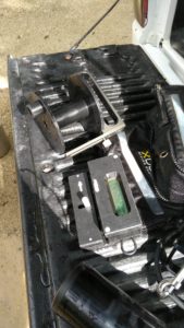
Much of the cave line was left as ‘exploration line’ after the most recent explorations in 2016. Many of the jumps started very close to the mainline as reach jumps and there were many T intersections remaining. To get a better idea of the set up of the lines I systematically resurveyed all of the upstream lines, and much of the downstream lines. Downstream continues and is where the Ox Bel Ha connection was made so as a result, I limited my resurvey to the first thousand meters / three thousand feet. Also, a team from the Mexico Cave Exploration Project (MCEP) had added some lines in the downstream section. This resurveying was done with a number of different dive buddies, and I used a mix of the traditional survey slate and Mnemo. Given the crumbly and small nature of some of the lines, the Mnemo dramatically increased the efficiency and safety of this project. As it was by the end of 2018 I had resurveyed over fifteen thousand feet of line.
Cleaning Up Lines
Once the majority of the resurvey was complete I could begin work on cleaning up the lines. Over a number of dives, jumps were cut further back, where they had been left as reach jumps and T intersections were taken out. This is to help keep divers safe, making it less likely for divers to inadvertently make a visual jump or swim over a T intersection in low visibility due to percolation or halocline. The intention of this was not to change existing lines but to create a situation where divers must make a clear navigational decision to put in their own jump line rather than navigate a T intersection.
Further Explorations
Having completed resurveying much of the historic lines I noticed that there were many leads or blank spaces on my map. Knowing where the lines went meant that I could effectively target my exploration efforts where I knew there were no other lines. By the end of 2018, I had added over three thousand feet of line in new cave passages. Some of these continue or have revealed more leads, so this will be an ongoing project! The resurvey data, and new exploration data was reported to the Quintana Roo Speleological Survey. This was to allow for comparison with the old data, and to inform future exploration.
Around The Cenote
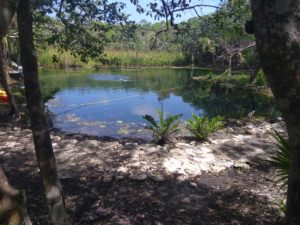
The landowners have been busy making the cenote more comfortable for swimmers and divers. There is dedicated parking for divers closer to the water than other people are able to use. They have put in proper bathroom facilities, which are kept clean (very important, have you ever dived at Angelita or Calavera?). There are also ample tables, chairs and sun lounges making it a great place to hang out and have a post-dive relax and beverage.
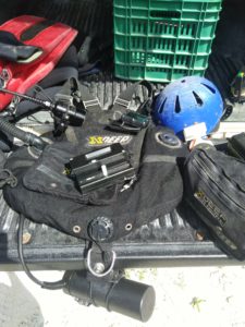
This has been an amazing project to have, as it is a cave that grows your skills as a diver. I used a mix of the traditional manual survey and the Mnemo survey device, both to keep my skills sharp, but some sections of the cave lent themselves to each. The big main passages were easy enough to survey with my trusty slate, while the halocline and smaller sections were nice to have the Mnemo for. I did pretty much all the dives there with my X-Deep Stealth Rec wing; even doing double stage dives this was the perfect tool. As the distances grew it was also nice to be able to borrow scooters from ProTec to move on to the further away sections. During 2018 I did 27 dives with more than 42 hours in water.
Many thanks to Don Victor and family, dive buddies Roxanne Rodriguez, Jean-Charles Erba, Gosia Mateja, Pete Delannoy, Rob Bartlet, Jaime de la Puerta, and Kim Davidson. Many, many other dives I completed on my own, diving solo in the smaller sections. Also thanks to Alison Perkins and Cameron Russo for contributing some of their data for the project.
Article written by Skanda Coffield


