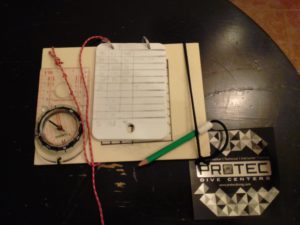
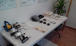
In December 2016, I managed to squeeze in a few days of Underwater Cave Survey and Cartography training with Kim Davidsson (ProTec manager, instructor, explorer) and Tamara (colleague, amazing diver, Melburnian). It was a great course (we expect nothing less from ProTec instructors), we learned about an aspect of cave diving that I had heard people talk about, but had never given too much thought to. We had a really interesting classroom session then made our survey slates before doing some dry surveying practice.
One of the key things that came from the classroom session was the requirement to survey exploration lines (something I hope to do one day), because without the survey data, there is no point laying line. As Kim says, “if you don’t know where you’ve been, you have not been there…” As cave divers and cave explorers we have a responsibility to the rest of the community to share our discoveries and lay the path for future explorers and cave divers. I am looking forward to continuing the “exploration” part of the workshop and I am excited to one day lay my own line in virgin passage and survey it.
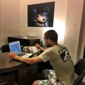
The next day we went off to Cenote Carwash to practice surveying lines, before learning how to plug the data into a computer program (in this case Arianne’s Line). With the data in the program we were able to see the lines we had surveyed, and check how far off our errors were. It was a very cool experience and that really makes you appreciate the many hours of hard work that go into exploring and surveying caves!
After completing the survey workshop I wanted to put the new skills to practice. After some discussion with the guru, Kim, I decided my project would be to resurvey Mayan Blue. It has been an interesting experience to resurvey the lines in Mayan Blue for a number of reasons. Most importantly, it has been a great excuse to go down many of the lines that I had previously overlooked! I always knew it was a big cave, but diving and surveying gives a picture to this reality. I love to see the “big picture” growing together and knowing each section of cave intimately is very rewarding. Many times we dive caves a few times and then move onto other sites, but so many of the caves here are so big that each dive you can go somewhere new. After exhausting the options close to the entrances on back-gas (or side-gas), I then started to add stage tanks to my dives to get further back into the cave. Going down lines that don’t get frequently dived, where the guideline is covered in a layer of silt, is an exciting experience and shows how once you get off the beaten path there are many areas of busy caves that very few people dive.
Surveying during dives has been both a challenge and a reward. Practicing surveying has made my skills improve as my work flow and abilities with the survey slate get better. Developing these skills will continue to reward, already I have been able to survey faster and with greater accuracy. This is a clear case of what Protec teaches and believes – that courses give people an opportunity to learn and practice skills in a safe environment, but divers need to continue to practice these skills to improve them (and prevent their deterioration). From the perspective of developing new skills the course was a good start and every dive I have surveyed on since has continued to build on those skills.
Another reward is seeing the survey data once it has been entered into the computer (and doing many dives in the same cave) has really helped me to learn the cave and it’s lines. This is invaluable for guiding clients and being able to explain where a certain jump is, or drawing accurate stick maps of the lines, where arrows are and how long it takes to reach them. As it is, there is still much cave to resurvey so the project will continue! There is something cool about seeing the in water work you do turn into an accurate stick map.
For those cave divers who are interested in a new challenge, and would like to learn new skills I highly recommend the Underwater Cave Survey and Cartography course Protec teaches. It is great to gain an understanding of the survey process and all the work that goes into surveying cave passages.


